South Cle Elum, Washington · Yakima County · Campground
Overview Kaner Flat Group Campground is situated in the foothills on the east side of the Cascades mountain range in the Okanogan-Wenatchee National Forest.Recreation Kaner Flat Group Campground offers outdoor enthusiasts the opportunity to hike, fish, ski, raft and enjoy a multitude of outdoor recreational activities …
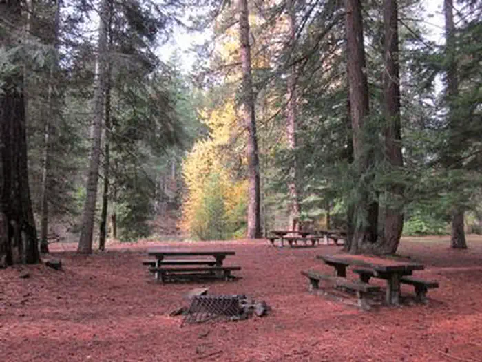
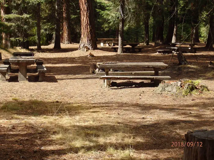
Overview Kaner Flat Group Campground is situated in the foothills on the east side of the Cascades mountain range in the Okanogan-Wenatchee National Forest.Recreation Kaner Flat Group Campground offers outdoor enthusiasts the opportunity to hike, fish, ski, raft and enjoy a multitude of outdoor recreational activities throughout the year. Nearby American Ridge Trail offers hikers, overnight backpackers and horseback riders fantastic opportunities to absorb some of the area's stunning beauty. Extending from Bumping River to the notable Pacific Crest trail, the American Ridge Trail offers over 26 miles of towering forests, stretches of meadows, alpine lakes and ridge line views. Trails for off-road, motorized recreation abound in this area, although some only allow specific types of vehicles. Visitors should be sure to check area maps. Backpacking in the nearby Goat Rocks Wilderness is also a popular pastime. The peaks within the area are remnants of an extinct volcano, taking the name "Goat Rocks," in honor of the numerous mountain goats traversing this isolated region. Gilbert Peak is the highest summit in this area, at an elevation of 8,184 feet. Facilities Kaner Flat Group Campground has one large site with multiple tenting locations, which can accommodate up to 60 guests. The site is equipped with picnic tables, campfire rings and vault toilets. Entrance to the campground is through a locked gate. The combination to the lock will be included in the confirmation letter. Access to drinking water can be found across the street at Kaner Flat campground. Natural Features Okanogan-Wenatchee National Forest offers stunning scenic views, with high, glaciated alpine peaks, valleys of old growth forest and rugged shrub-steppe country making up the diverse landscape. Elevations range from below 1,000 feet to more than 9,000 feet. Precipitation varies greatly throughout the area, ranging from approximately 140 inches along the Cascade Crest to only 10 inches along the easter
Photos
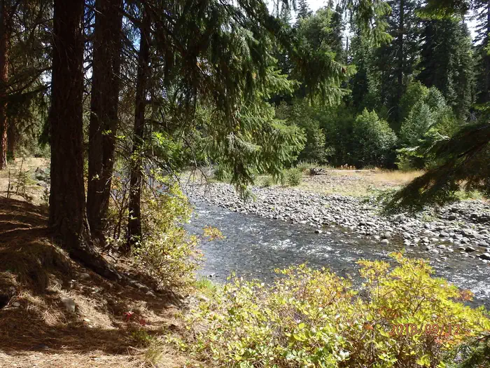
Little Naches — USFSLittle Naches — USFSKaner Flat Group Site — USFSPicnic tables, fire ring, flat needle covered ground in conifer forest with bright yellow deciduous trees in background. — USFS
How to Get There
From Naches, WA travel west on US Highway 12 for 4.4 miles. Continue straight onto State Route (SR) 410 W for 24.2 miles. Turn north (right) on Little Naches Road / Forest Road 19 and follow for 2.5 miles. The site is on the left side of the road, parallel to the river. From Enumclaw, WA depart SR 164/Griffin Ave toward Wells St. After ½ mile turn left onto SR 410/Roosevelt Ave. Follow SR 410 approximately 76 miles east to the intersection with Little Naches Road/Forest Road 19. Turn north on FR 19 and follow for 2.5 miles.
Download your route in advance via Gaia, Caltopo, or OSM-based apps.
Recommendations adapt to the current forecast + trail stats. Use them as a starting point — local conditions, your experience, and the time of day you start all matter.
Plan Your Visit to KANER FLAT GROUP SITE
Heading to KANER FLAT GROUP SITE? A few things to know before you go:
Reservations: popular sites fill up fast — check Recreation.gov 6 months in advance
Fees: day-use and camping fees vary; check current rates on the official park page
Trash & pack-out: follow Leave No Trace principles
Wildlife: store food in bear boxes where provided; never feed wildlife
Weather: the 5-day forecast above is updated every 6 hours; verify just before you go
Frequently Asked Questions
Do I need a reservation for KANER FLAT GROUP SITE?
No central reservation system listed for KANER FLAT GROUP SITE. Check the official page (https://www.recreation.gov/camping/campgrounds/233985) for the latest entry policy and availability.
How do I get to KANER FLAT GROUP SITE?
From Naches, WA travel west on US Highway 12 for 4.4 miles. Continue straight onto State Route (SR) 410 W for 24.2 miles. Turn north (right) on Little Naches Road / Forest Road 19 and follow for 2.5 miles. The site is on the left side of the road, parallel to the river. From Enumclaw, WA depart SR 164/Griffin Ave toward Wells St. After ½ mile turn left onto SR 410/Roosevelt Ave. Follow SR 410 appr…