FacilityFacilityRecreation.gov

Gauley Tailwaters

Mount Lookout, Virginia · Nicholas County · Facility

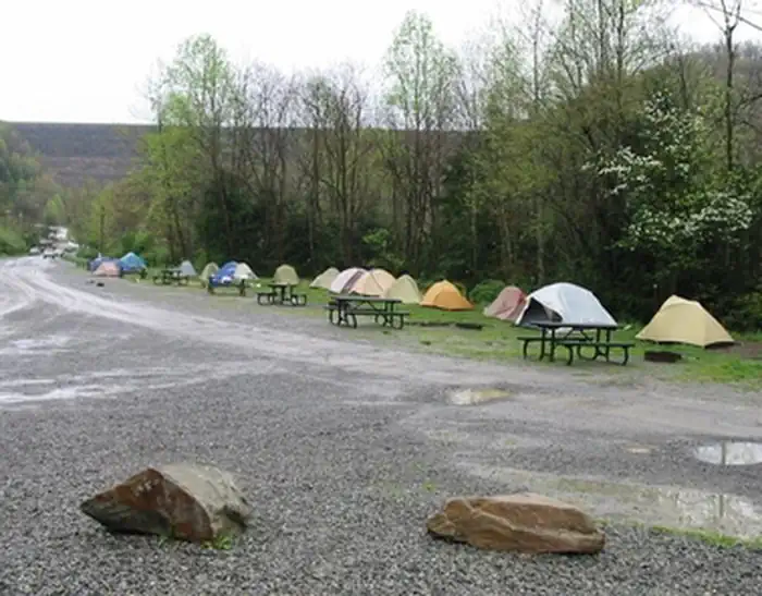
The National Park Service offers primitive camping at Gauley Tailwaters, located just below Summersville Dam. From Route 19 at Mt. Nebo, take Route 129 west across the dam, then turn left at the river access sign. Bear right through the parking lot to the campsites. There are 18 drive-in sites for tents and RVs. Camp o…

Advertisement
38.21439, -80.88885
Open in OpenStreetMap
5-Day Forecast

Weather at Gauley Tailwaters

Live forecast for the park. Plan your visit accordingly.

Avg High74°F
Avg Low51°F
Peak Rain Chance17%
Humidity60%
UV (avg)8
Air Quality35 · Good
Today
☁️
Overcast
77°/51°
🌬 9mph
6:02 AM8:40 PM
Mon
☁️
Overcast
72°/54°
🌬 7mph
6:02 AM8:41 PM
Tue
🌦
Light Drizzle
71°/51°
💧 17%🌬 12mph
6:01 AM8:41 PM
Wed
☁️
Overcast
74°/48°
💧 2%🌬 9mph
6:01 AM8:42 PM
Thu
☁️
Overcast
78°/51°
💧 1%🌬 8mph
6:01 AM8:43 PM

Forecast data © Open-Meteo. Refreshed every 6 hours. Always check the most recent forecast before heading out.

About Gauley Tailwaters

The National Park Service offers primitive camping at Gauley Tailwaters, located just below Summersville Dam. From Route 19 at Mt. Nebo, take Route 129 west across the dam, then turn left at the river access sign. Bear right through the parking lot to the campsites. There are 18 drive-in sites for tents and RVs. Camp only at designated sites. RV, camper, or car camping in non-designated sites, walk-in sites, or any parking area is strictly prohibited.

How to Get There

The National Park Service offers primitive camping at Gauley Tailwaters, located just below Summersville Dam. From Route 19 at Mt. Nebo, take Route 129 west across the dam, then turn left at the river access sign. Bear right through the parking lot to the campsites. There are 18 drive-in sites for tents and RVs.

Driving directions (Google Maps) →

Plan Your Visit to Gauley Tailwaters

Heading to Gauley Tailwaters? A few things to know before you go:

  • Reservations: popular sites fill up fast — check Recreation.gov 6 months in advance
  • Fees: day-use and camping fees vary; check current rates on the official park page
  • Trash & pack-out: follow Leave No Trace principles
  • Wildlife: store food in bear boxes where provided; never feed wildlife
  • Weather: the 5-day forecast above is updated every 6 hours; verify just before you go

Frequently Asked Questions

Do I need a reservation for Gauley Tailwaters?

No central reservation system listed for Gauley Tailwaters. Check the official page (https://www.recreation.gov/camping/campgrounds/258782) for the latest entry policy and availability.

How do I get to Gauley Tailwaters?

The National Park Service offers primitive camping at Gauley Tailwaters, located just below Summersville Dam. From Route 19 at Mt. Nebo, take Route 129 west across the dam, then turn left at the river access sign. Bear right through the parking lot to the campsites. There are 18 drive-in sites for tents and RVs.

How do I contact Gauley Tailwaters?

You can reach the park at phone: (304) 465-0508 or email: neri_interpretation@nps.gov.