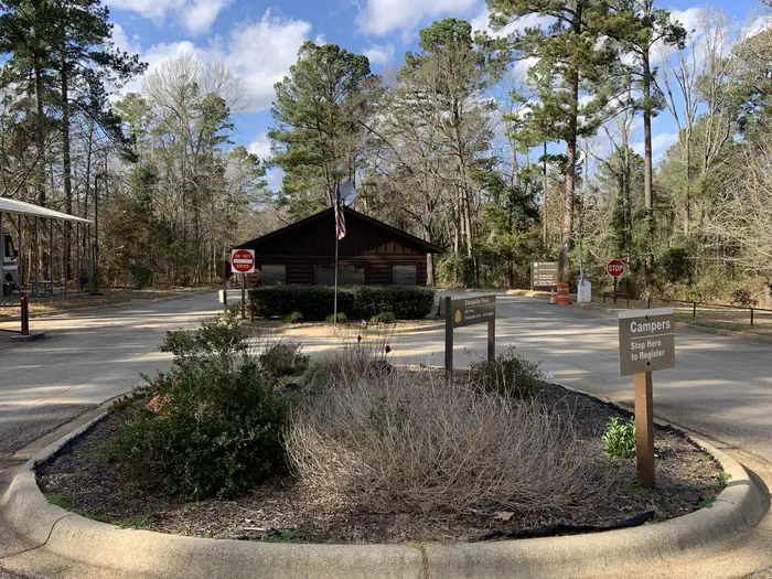
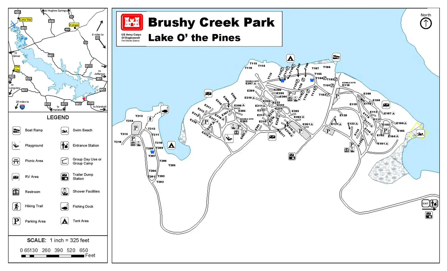
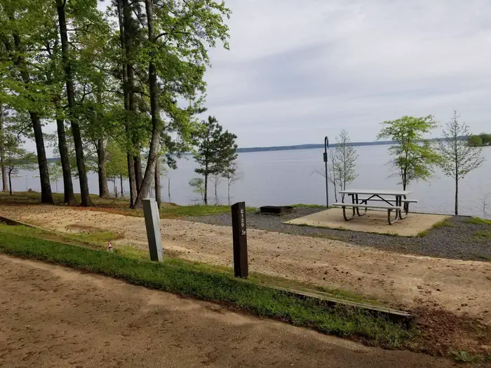
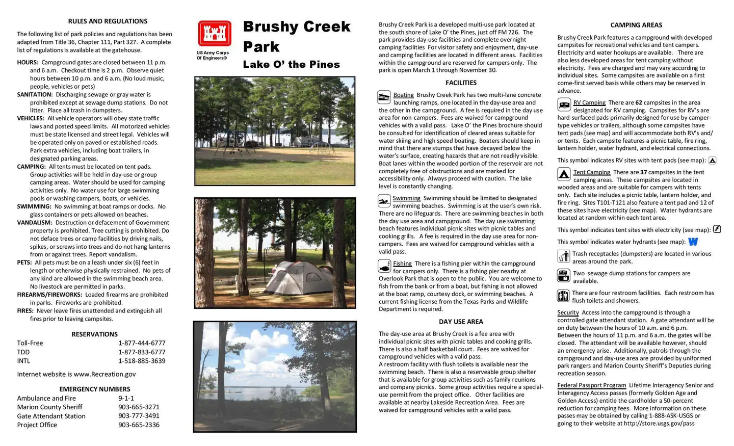
Overview Brushy Creek Campground is situated along the banks of Lake O' the Pines in the Ark-La-Tex portion of the Pineywoods of east Texas near the states of Arkansas, Oklahoma, and Louisiana. Gate House Hours: 10am-6pm Monday through Saturday, 12pm-6pm Sunday. Address to get here: 189 Brushy Creek Park Rd. Jefferson,…
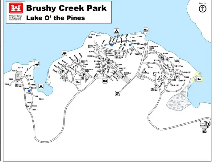
Overview Brushy Creek Campground is situated along the banks of Lake O' the Pines in the Ark-La-Tex portion of the Pineywoods of east Texas near the states of Arkansas, Oklahoma, and Louisiana. Gate House Hours: 10am-6pm Monday through Saturday, 12pm-6pm Sunday. Address to get here: 189 Brushy Creek Park Rd. Jefferson, TX 75657 Recreation Boating, fishing, water sports, and wildlife viewing are all popular pastimes at the campground. Hunting opportunities for white-tailed deer, waterfowl, and small game are available on nearby public lands. Lake O' the Pines fishing includes largemouth, spotted, and white bass along with crappie, catfish, and sunfish. In addition to boat fishing there are areas for bank fishing along the shore and below the dam along Big Cypress Bayou. Birdwatchers are also encouraged to bring their binoculars as numerous resident and migratory bird species inhabit the area. Bald eagle sightings are a common occurrence in fall and winter and they are occasionally sighted in spring and summer.Facilities Brushy Creek features 62 RV campsites with water and electric hookups. There are also 37 tent campsites, 12 of these sites have electricity available. Restrooms with showers are located in each section of the park. Trash receptacles are located throuhout the park. A boat ramp, courtesy dock, playground, swimming beach, fishing dock, and sewer dump station are also provided.Natural Features Lake O' the Pines includes about 18,700 acres of water and 9,000 acres of land, encompassing an area so large it spans five counties. The lake was created by the construction of the Ferrell's Bridge Dam on the Big Cypress Bayou. The reservoir was originally created as part of the overall plan for flood control in the Red River Basin below Denison Dam in Oklahoma, and has now become a recreational oasis for outdoor enthusiasts. Nearby Attractions The nearby towns of Jefferson and Marshall offer plenty of historic and tourist attractions, and Texas Wildflower Trail ro
Photos
Brushy Creek Full Map — LOPRV 1 — LOPBrushy Creek Brochure Front — LOPBrushy Creek Map — LOP
How to Get There
From Jefferson, TX, travel 3.8 miles northwest on Highway 49. Turn left onto FM 729 and continue for approximately 3.5 miles, then turn left again onto FM 726. Travel 5.0 miles, turn right at the stop sign and follow signs to the park entrance.
Download your route in advance via Gaia, Caltopo, or OSM-based apps.
Recommendations adapt to the current forecast + trail stats. Use them as a starting point — local conditions, your experience, and the time of day you start all matter.
Plan Your Visit to BRUSHY CREEK
Heading to BRUSHY CREEK? A few things to know before you go:
Reservations: popular sites fill up fast — check Recreation.gov 6 months in advance
Fees: day-use and camping fees vary; check current rates on the official park page
Trash & pack-out: follow Leave No Trace principles
Wildlife: store food in bear boxes where provided; never feed wildlife
Weather: the 5-day forecast above is updated every 6 hours; verify just before you go
Frequently Asked Questions
Do I need a reservation for BRUSHY CREEK?
No central reservation system listed for BRUSHY CREEK. Check the official page (https://www.recreation.gov/camping/campgrounds/232534) for the latest entry policy and availability.
How do I get to BRUSHY CREEK?
From Jefferson, TX, travel 3.8 miles northwest on Highway 49. Turn left onto FM 729 and continue for approximately 3.5 miles, then turn left again onto FM 726. Travel 5.0 miles, turn right at the stop sign and follow signs to the park entrance.