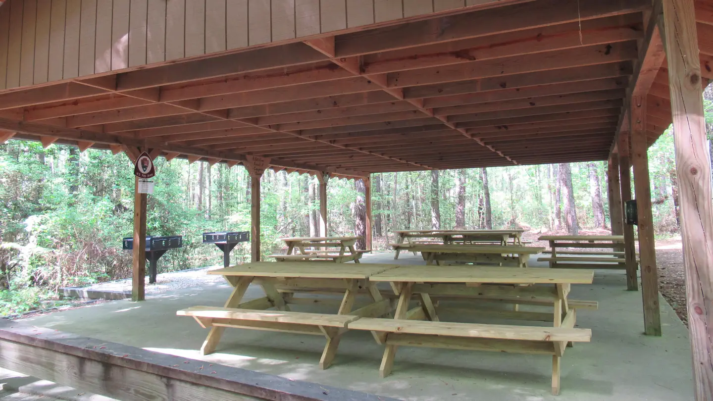
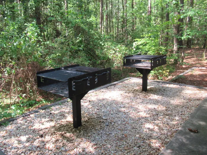
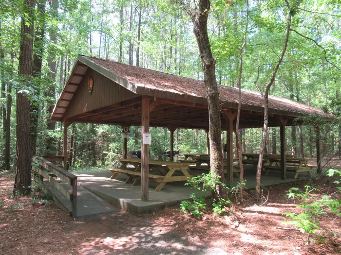
Overview The Congaree Picnic Shelter is located a short distance from the Harry Hampton Visitor Center and is adjacent to the park's primary parking area. The picnic shelter is also near the park's popular Boardwalk Trail. Recreation Congaree National Park offers a wide range of opportunities to explore and experience …
Overview The Congaree Picnic Shelter is located a short distance from the Harry Hampton Visitor Center and is adjacent to the park's primary parking area. The picnic shelter is also near the park's popular Boardwalk Trail. Recreation Congaree National Park offers a wide range of opportunities to explore and experience the great outdoors. Many miles of hiking trails can be found in the park ranging from easy to moderately strenuous. Old growth forests, teeming with wildlife can be accessed by park trails or by exploring the many miles of waterways in a canoe or kayak. Interpretive programs including guided hikes, canoe tours and special ranger-led programs are offered throughout the year. Facilities The picnic shelter offers picnic tables and two large barbeque grills, as well as trash and recycling cans. Natural Features The picnic shelter is located in an upland pine forest. The shelter is a short walk away from the Boardwalk Trail, which takes visitors into the old-growth floodplain forest that Congaree is most notable for, as well as access to other trails that take visitors into the park's backcountry where they can see champion-sized trees and wildlife. The shelter is also close to trails that take visitors through the upland pine forest where they can see how fire is a natural part of the ecosystem and is used to maintain and restore this fire-dependent habitat. Nearby Attractions Congaree National Park is located near many attractions including state parks, forests and parks. The city of Columbia is a short drive from the park and offers access to many attractions including museums, city parks and shopping. Charges & Cancellations Customers who cancel a picnic shelter reservation less than seven (7) days before the arrival date will forfeit the total fee.
Photos
Congaree Picnic Shelter — NPSBarbeque grills at the Congaree Picnic Shelter — NPSCongaree Picnic Shelter. — NPS
How to Get There
From Spartanburg - Follow Interstate 26 east towards Charleston for 92 miles and then take Exit 116 for Interstate 77 north towards Charlotte (on the left). Follow Interstate 77 for approximately five miles to Exit 5, Bluff Road. Follow directions below from I 77, Exit 5. (Approximate travel time: 2 hours) From Charleston - Follow Interstate 26 west (towards Columbia) for approximately 75 miles. Take Exit 145, US 601 north towards St. Matthews. Follow US 601 for 23 miles. Turn left onto Route 48 (Bluff Road) and follow for 11 miles to Mt. View Road. Turn left and follow Mt. View Road to Old Bluff Road. Turn right on Old Bluff Road for half a mile to the park entrance, which will be on your left. (Approximate travel time: 2 hours) From Charlotte - Take Interstate 77 south towards Columbia for approximately 95 miles to Exit 5, Bluff Road. Follow directions below from Interstate 77, Exit 5. (Approximate travel time: 2 hours) From Augusta, GA - Follow Interstate 20 east towards Columbia for 65 miles to Exit 64B. Merge onto Interstate 26 and follow for 8 miles to Exit 116, Interstate 77 north towards Charlotte (on the left). Follow Interstate 77 for 5 miles to Exit 5, Bluff Road. Follow directions below from Interstate 77, Exit 5. (Approximate travel time: 1 hour 45 minutes) From Interstate 77, Exit 5 At Exit 5 turn onto SC Hwy 48 East/Bluff Road - Following the brown and white "Congaree National Park" directional signs, travel approximately 8 miles on and then take a slight right
Download your route in advance via Gaia, Caltopo, or OSM-based apps.
Recommendations adapt to the current forecast + trail stats. Use them as a starting point — local conditions, your experience, and the time of day you start all matter.
Plan Your Visit to Congaree Picnic Shelter
Heading to Congaree Picnic Shelter? A few things to know before you go:
Reservations: popular sites fill up fast — check Recreation.gov 6 months in advance
Fees: day-use and camping fees vary; check current rates on the official park page
Trash & pack-out: follow Leave No Trace principles
Wildlife: store food in bear boxes where provided; never feed wildlife
Weather: the 5-day forecast above is updated every 6 hours; verify just before you go
Frequently Asked Questions
Do I need a reservation for Congaree Picnic Shelter?
No central reservation system listed for Congaree Picnic Shelter. Check the official page (https://www.recreation.gov/camping/campgrounds/10130529) for the latest entry policy and availability.
How many campsites are at Congaree Picnic Shelter?
Congaree Picnic Shelter has 2 campsites. Site amenities (hookups, vehicle limits, ADA access) vary — see the individual campsite pages for details.
How do I get to Congaree Picnic Shelter?
From Spartanburg - Follow Interstate 26 east towards Charleston for 92 miles and then take Exit 116 for Interstate 77 north towards Charlotte (on the left). Follow Interstate 77 for approximately five miles to Exit 5, Bluff Road. Follow directions below from I 77, Exit 5. (Approximate travel time: 2 hours) From Charleston - Follow Interstate 26 west (towards Columbia) for approximately 75 miles. T…
How do I contact Congaree Picnic Shelter?
You can reach the park at phone: 803.776.4396 or email: [email protected].