Overview The Ochoco Divide Group Site is a convenient place to camp while traveling across scenic State Highway 26 by bicycle or car. Resting at the top of the Ochoco Divide at an elevation of 4,700 ft., the group site is set on a hill away from the road as an extension of the general campground. Summertime in the Ocho…
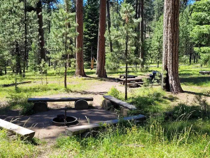
Overview The Ochoco Divide Group Site is a convenient place to camp while traveling across scenic State Highway 26 by bicycle or car. Resting at the top of the Ochoco Divide at an elevation of 4,700 ft., the group site is set on a hill away from the road as an extension of the general campground. Summertime in the Ochoco National Forest brings pleasant temperatures; the campground is closed during winter.Recreation The group site of the Ochoco Divide Campground is mainly used by touring cyclists. It is also a good place to take a relaxing stroll through the woods. There are opportunities for hunting, mountain biking and hiking in the national forest surrounding the facility. Several trailheads begin at the Bandit Springs rest stop about one mile from the campground on Highway 26.Facilities The group site is part of the main Ochoco Divide Campground. There is excellent quality drinking water throughout the main campground and near the group site. The group site can comfortably fit up to 12 people; no more than 35 are allowed. Parking is limited. Campers must park at the base of a small hill and walk up to the site. There is a large group size fire ring as well. Natural Features The scenery surrounding the campground alternates between thick Ponderosa pine forests and grassy meadows, though shortly beyond the campground the road descends into lower-elevation, arid canyon lands. One of the most unique geologic features of the Ochoco National Forest is the 'thunder egg,' Oregon's official state rock. Thunder eggs are small, colorful, round volcanic rocks similar to geodes that have been exposed over time. The U.S. Forest Service has designated specific sites for rock hounding. Nearby Attractions John Day Fossil Beds National Monument is less than an hour away. Hike amongst the Painted Hills and famed fossils, take a journey through time at the museum at Sheep Rock or picnic beneath the beautiful mountain scenery. John Day Fossil Beds National Monument
Photos
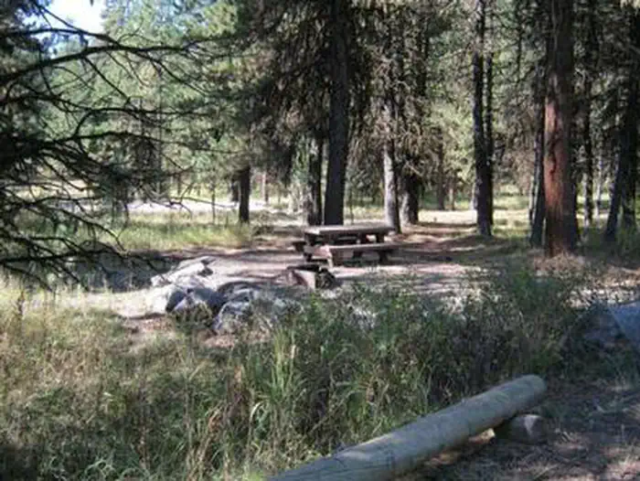
GROUP SITE — noneOCHOCO DIVIDE Campground — NoneOCHOCO DIVIDE GROUP SITE
How to Get There
From Prineville, Oregon travel approximately 28 miles on State Highway 26. The campground is on the right at the top of the divide.
Download your route in advance via Gaia, Caltopo, or OSM-based apps.
Recommendations adapt to the current forecast + trail stats. Use them as a starting point — local conditions, your experience, and the time of day you start all matter.
Plan Your Visit to OCHOCO DIVIDE GROUP SITE
Heading to OCHOCO DIVIDE GROUP SITE? A few things to know before you go:
Reservations: popular sites fill up fast — check Recreation.gov 6 months in advance
Fees: day-use and camping fees vary; check current rates on the official park page
Trash & pack-out: follow Leave No Trace principles
Wildlife: store food in bear boxes where provided; never feed wildlife
Weather: the 5-day forecast above is updated every 6 hours; verify just before you go
Frequently Asked Questions
Do I need a reservation for OCHOCO DIVIDE GROUP SITE?
No central reservation system listed for OCHOCO DIVIDE GROUP SITE. Check the official page (https://www.recreation.gov/camping/campgrounds/233406) for the latest entry policy and availability.
How do I get to OCHOCO DIVIDE GROUP SITE?
From Prineville, Oregon travel approximately 28 miles on State Highway 26. The campground is on the right at the top of the divide.
How do I contact OCHOCO DIVIDE GROUP SITE?
You can reach the park at phone: 541-351-1182 or email: [email protected].