South International Falls, Minnesota · Koochiching County · Campground
Overview ** PLEASE READ IMPORTANT INFORMATION BELOW TO UNDERSTAND HOW TO CAMP AT VOYAGEURS NATIONAL PARK **All frontcountry and backcountry campsites require travel by private watercraft or water taxi to access.Click on any campsite name when searching sites to view boating distances.You can type in a specific campsite…
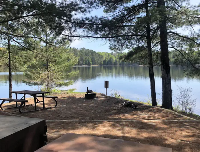
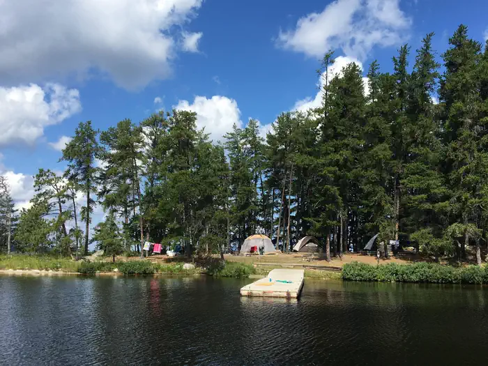
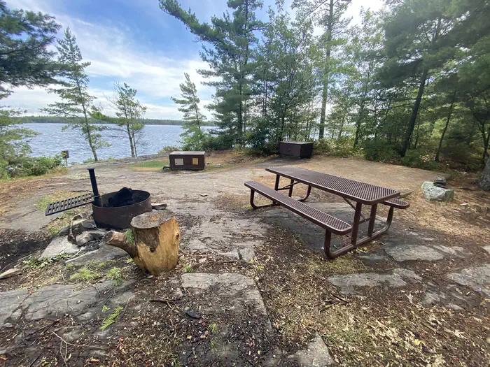
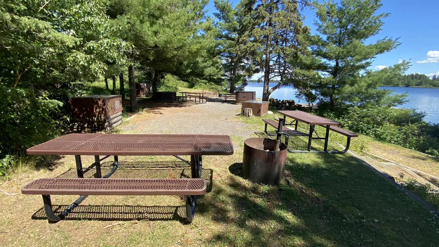
Overview ** PLEASE READ IMPORTANT INFORMATION BELOW TO UNDERSTAND HOW TO CAMP AT VOYAGEURS NATIONAL PARK **All frontcountry and backcountry campsites require travel by private watercraft or water taxi to access.Click on any campsite name when searching sites to view boating distances.You can type in a specific campsite number or campsite/lake name when searching site availability.Voyageurs National Park has 143 frontcountry, 14 backcountry, and 2 primitive campsites for visitors wanting an authentic Northwoods camping experience. PRIMITIVE CAMPSITES (Red Pine & Blueberry Ridge) are the only campsites that are located on the mainland and DO NOT require a boat to access. They are hike-in sites along the Kab-Ash Trail and are equipped only with fire rings and cleared areas for tents. Leave No Trace Principles apply in these areas.FRONTCOUNTRY CAMPSITES are located on the large lakes (Rainy, Kabetogama, Namakan, Sandpoint). You can boat directly to them from any park visitor center boat ramp. They offer fire rings, tent pads, picnic tables, bear lockers for safe food storage, and outdoor privies. Ten of the frontcountry sites throughout the park are available on a one-week booking window to accommodate short-term trip planners.BACKCOUNTRY CAMPSITES are located on the park's interior lakes and offer a more remote and secluded camping experience consisting of fire rings, tenting areas, an outdoor privy, a bear pole for safe food storage, and a canoe. These sites first require travel by private watercraft or local water taxi service to a remote trailhead and then hiking up to several miles to the backcountry lakes. All backcountry campsite reservations include the use of one canoe and an access code will be provided in your confirmation email. Some campsites can be hiked to directly while others require paddling after hiking. Canoes on backcountry lakes are provided by the park and remain stationed at these lakes. Personal watercrafts of any kind cannot be portaged into ba
Photos
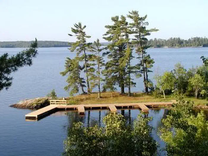
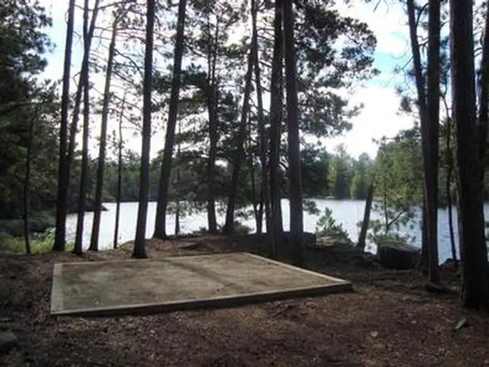
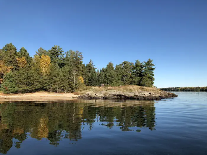
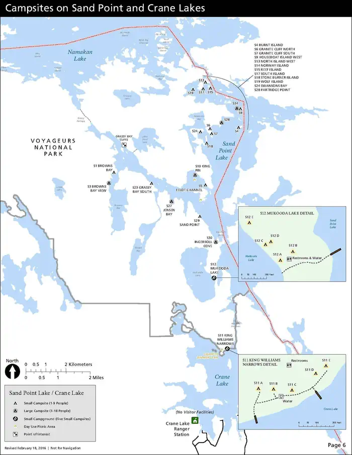
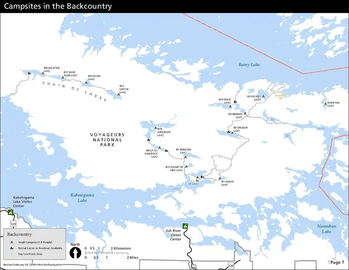
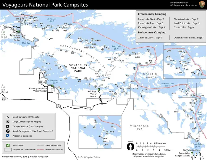
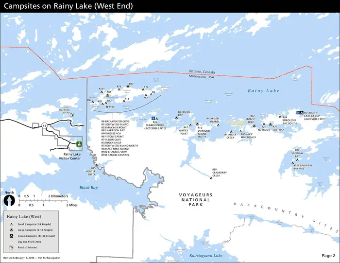
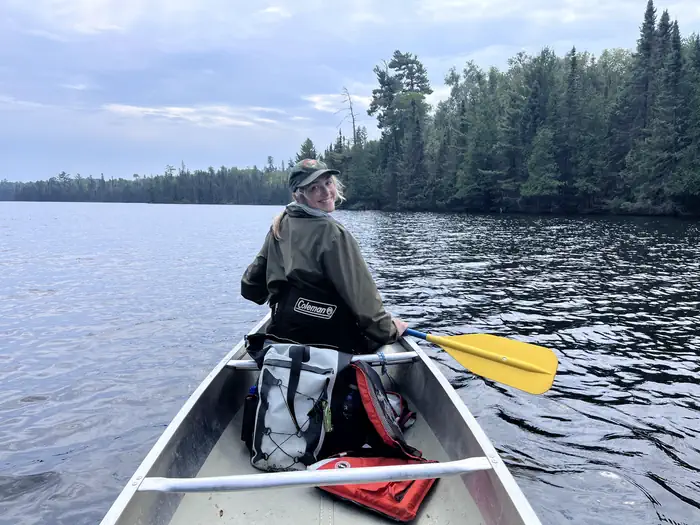
Aerial view of the Kabetogama Lake Group campsite with three large docks overlooking a large, scenic lake. — NPS PhotoLost Bay Campsite on Kabetogama Lake — NPSSquare tent pad surrounded by trees and a scenic lake. — NPS PhotoCampsite on Rainy Lake — NPSCampsite on Rainy Lake — NPSMarrs Point Campsite on Kabetogama Lake — NPSLarge campsite on Rainy Lake — NPSA map depicts the location of each campsite on Sand Point Lake and Crane Lake in Voyageurs National Park--all of which are only water-accessible. — NPSA map depicts the location of each backcountry campsite in Voyageurs National Park--all of which are only water-accessible, and some of which also require hiking and/or paddling once the large lakes are crossed. — NPS GraphicA map depicts each the location of each campsite in Voyageurs National Park--all of which are only water-accessible. — NPSA map depicts the location of each campsite on the west side of Rainy Lake in Voyageurs National Park--all of which are only water-accessible. — NPS GraphicWoman in canoe smiles back while paddling on a calm lake with a treeline in the background. — NPS/Adam Mathews
How to Get There
VEHICLE:Voyageurs National Park is approximately 5 hours north of Minneapolis-St. Paul on I-35 and Hwy 53, 3 hours north of Duluth on Hwy 53, and 4 hours south from Winnipeg, Manitoba. PLANE: Falls International Airport is located in International Falls, Minnesota. Taxi service and rental cars are available here. Most flights entering the area will pass through the larger Minneapolis-St. Paul airport located around 5 hours south of Voyageurs National Park.PUBLIC TRANSPORTATION: There is no public transportation to Voyageurs National Park. No bus lines or passenger trains serve this area.
Download your route in advance via Gaia, Caltopo, or OSM-based apps.
Recommendations adapt to the current forecast + trail stats. Use them as a starting point — local conditions, your experience, and the time of day you start all matter.
Plan Your Visit to Voyageurs National Park Camping Permits
Heading to Voyageurs National Park Camping Permits? A few things to know before you go:
Reservations: popular sites fill up fast — check Recreation.gov 6 months in advance
Fees: day-use and camping fees vary; check current rates on the official park page
Trash & pack-out: follow Leave No Trace principles
Wildlife: store food in bear boxes where provided; never feed wildlife
Weather: the 5-day forecast above is updated every 6 hours; verify just before you go
Frequently Asked Questions
Do I need a reservation for Voyageurs National Park Camping Permits?
No central reservation system listed for Voyageurs National Park Camping Permits. Check the official page (https://www.recreation.gov/camping/campgrounds/249981) for the latest entry policy and availability.
How do I get to Voyageurs National Park Camping Permits?
VEHICLE:Voyageurs National Park is approximately 5 hours north of Minneapolis-St. Paul on I-35 and Hwy 53, 3 hours north of Duluth on Hwy 53, and 4 hours south from Winnipeg, Manitoba. PLANE: Falls International Airport is located in International Falls, Minnesota. Taxi service and rental cars are available here. Most flights entering the area will pass through the larger Minneapolis-St. Paul airp…
How do I contact Voyageurs National Park Camping Permits?