Mc Daniels, Kentucky · Breckinridge County · Campground
Overview North Fork Campground is located on the shore of Rough River Lake in south central Kentucky. The 5,100-acre lake is a hometown paradise for visitors who love the outdoors, and more than two million visitors camp, picnic, fish, swim, boat and relax on the lake shore each year.Recreation A wide variety of recrea…
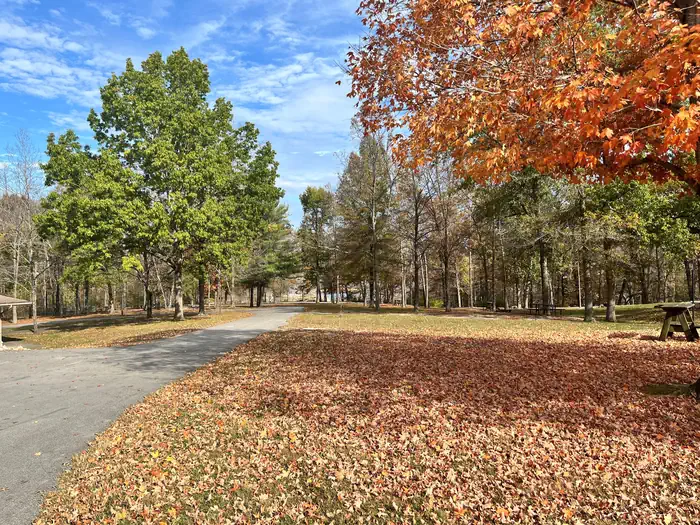
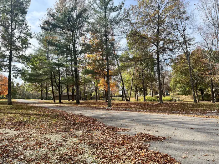
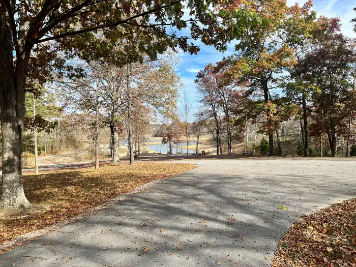
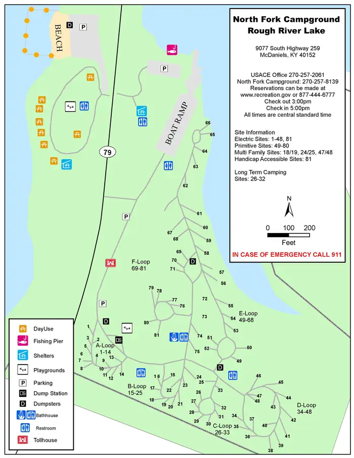
Overview North Fork Campground is located on the shore of Rough River Lake in south central Kentucky. The 5,100-acre lake is a hometown paradise for visitors who love the outdoors, and more than two million visitors camp, picnic, fish, swim, boat and relax on the lake shore each year.Recreation A wide variety of recreational activities and facilities are provided at the lake, including ample opportunities for boating and fishing. The most sought after fish are bass, crappie and catfish, and bass tournaments occur at the lake throughout the year. Additionally, pontoon, johnboat and jet ski rentals are available at the nearby marinas.Facilities North Fork Campground offers 81 sites, 50 of which have electric hookups. Several campsites are on the waterfront, while others are just a short walk away. Additional amenities include a dump station, playground, public beach, showers, two group shelters, boat ramp, basketball court, fishing pier and a day use picnic area. Wi-fi is available from an outside source at an additional fee.Natural Features The rolling, forested hills of rural south central Kentucky offer an extraordinary setting for those who visit the lake. Rough River Lake provides views of ancient sandstone, shale and limestone cliffs. An abundance of water in the area, both surface and underground, has carved through limestone to create a myriad of sinks and caverns. The lake itself is home to numerous species of wildlife, including migratory songbirds and waterfowl. Contact Info For facility specific information, please call (270) 257-8139. Nearby Attractions The historic Green Farm is adjacent to the lake. It consists of about 3,000 acres, a large ancestral home, an old water-powered mill and store and a golf course. George Washington once owned part of the land. Mammoth Cave National Park, which boasts the longest cave system in the world with more than 240 miles of mapped passageways, is about a one-hour drive away. Other nearby attractions also include the
Photos
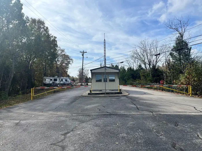
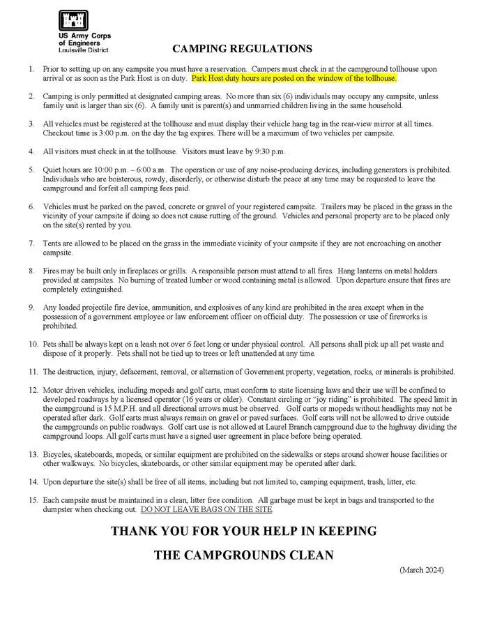
North Fork Campground — USACECamping Regulations — USACENorth Fork Campground — North Fork Campground (KY) — North Fork Campground Map — USACE
How to Get There
Begin at ramp onto I-64 West toward New Albany/St. Louis, traveling 22.3 miles. Take the IN-135, Exit Number 105, toward Palmyra/Corydon, onto IN-135 South toward Corydon, traveling 16.7 miles. Continue on Bypass Road KY-79 for 2.1 miles. Turn right onto KY-79, traveling 10.1 miles. Continue on 1st Avenue, KY-79S for 495 feet. Turn a slight right onto US-60, traveling 11.8 miles. Turn left onto KY-259/KY-79, traveling 9.1 miles. End at 9077 South Highway 259, McDaniels, KY. Distance is approximately 72 miles with an approximate travel time of 1 hour, 15 minutes.
Download your route in advance via Gaia, Caltopo, or OSM-based apps.
Recommendations adapt to the current forecast + trail stats. Use them as a starting point — local conditions, your experience, and the time of day you start all matter.
Plan Your Visit to NORTH FORK (KY)
Heading to NORTH FORK (KY)? A few things to know before you go:
Reservations: popular sites fill up fast — check Recreation.gov 6 months in advance
Fees: day-use and camping fees vary; check current rates on the official park page
Trash & pack-out: follow Leave No Trace principles
Wildlife: store food in bear boxes where provided; never feed wildlife
Weather: the 5-day forecast above is updated every 6 hours; verify just before you go
Frequently Asked Questions
Do I need a reservation for NORTH FORK (KY)?
No central reservation system listed for NORTH FORK (KY). Check the official page (https://www.recreation.gov/camping/campgrounds/233409) for the latest entry policy and availability.
How do I get to NORTH FORK (KY)?
Begin at ramp onto I-64 West toward New Albany/St. Louis, traveling 22.3 miles. Take the IN-135, Exit Number 105, toward Palmyra/Corydon, onto IN-135 South toward Corydon, traveling 16.7 miles. Continue on Bypass Road KY-79 for 2.1 miles. Turn right onto KY-79, traveling 10.1 miles. Continue on 1st Avenue, KY-79S for 495 feet. Turn a slight right onto US-60, traveling 11.8 miles. Turn left onto KY…