FacilityFacilityRecreation.gov

Payette River: Deer Creek

Banks, Idaho · Boise County · Facility

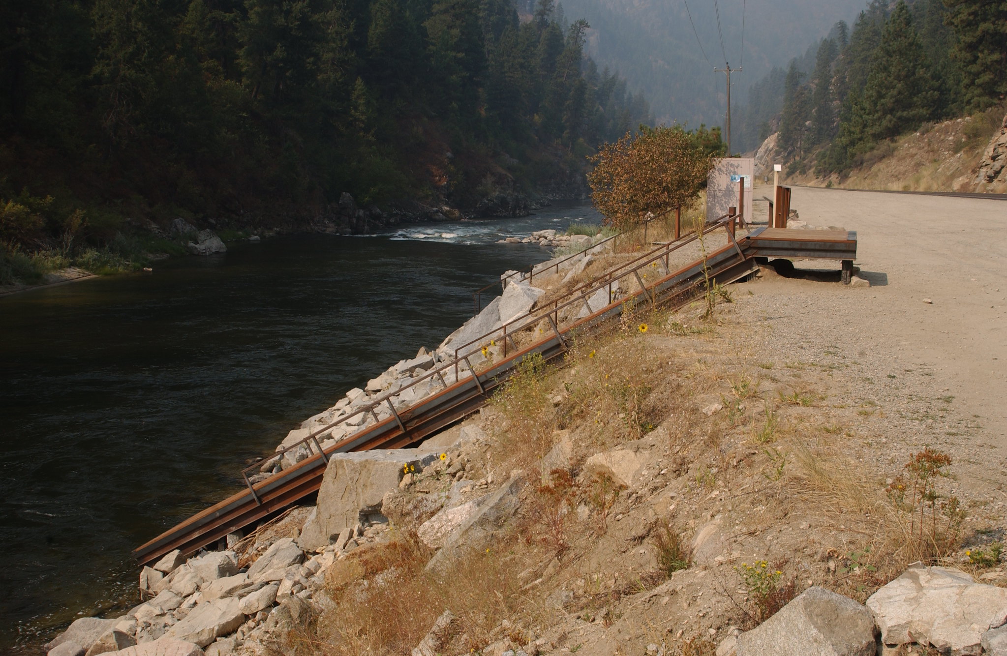
The South Fork Payette River is a classic pool-drop river cooperatively managed by the BLM and Boise National Forest. Deer Creek launch is a main put-in spot for the Class III-IV, "Staircase" section of the South Fork Payette River. many boaters will launch here to avoid the three miles of calm water from the Confluenc…

Advertisement
44.09222, -116.03250
Open in OpenStreetMap
5-Day Forecast

Weather at Payette River: Deer Creek

Live forecast for the park. Plan your visit accordingly.

Avg High77°F
Avg Low51°F
Peak Rain Chance1%
Humidity37%
UV (avg)7
Air Quality45 · Good
Today
☁️
Overcast
70°/53°
💧 1%🌬 13mph
6:04 AM9:18 PM
Sun
☁️
Overcast
73°/48°
🌬 10mph
6:04 AM9:19 PM
Mon
☁️
Overcast
76°/53°
🌬 9mph
6:03 AM9:20 PM
Tue
☁️
Overcast
79°/49°
🌬 9mph
6:03 AM9:20 PM
Wed
☁️
Overcast
85°/53°
💧 1%🌬 8mph
6:02 AM9:21 PM

Forecast data © Open-Meteo. Refreshed every 6 hours. Always check the most recent forecast before heading out.

About Payette River: Deer Creek

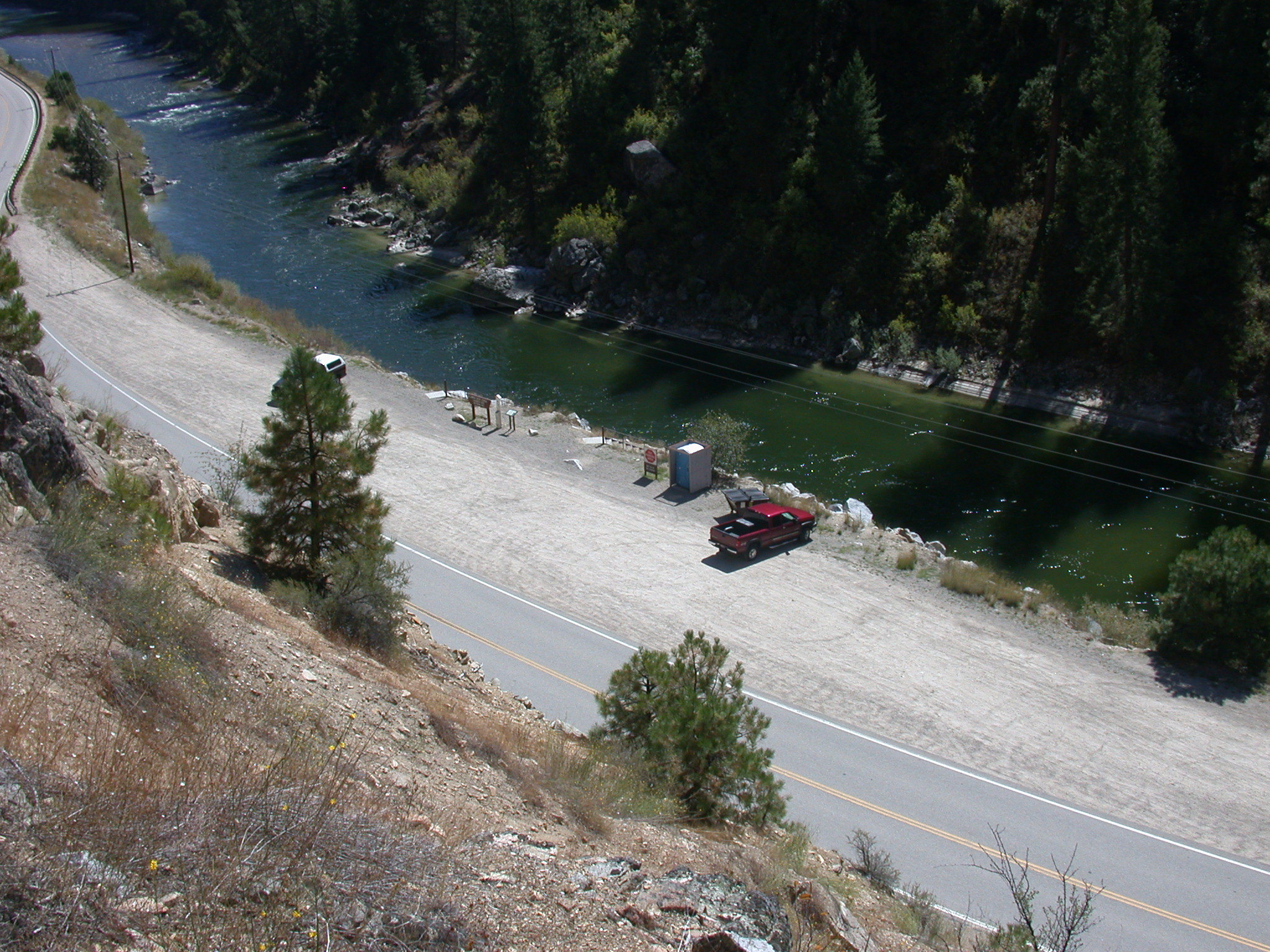
The South Fork Payette River is a classic pool-drop river cooperatively managed by the BLM and Boise National Forest. Deer Creek launch is a main put-in spot for the Class III-IV, "Staircase" section of the South Fork Payette River. many boaters will launch here to avoid the three miles of calm water from the Confluence Site. The site is essentially a very broad gravel area adjacent to the Banks-Lowman Highway. The facilities include a steep, steel and wood boat ramp, portable toilet, and information kiosk. This is a fee parking area - $5.00/day or $30.00 season pass for the Boise National Forest Annual Day Use Pass. Day passes are available on-site.Purchase online Boise National Forest Annual Day Use PassPayette River Maps (Boater's Guide)
How to Get There

Deer Creek Launch Site is located along the Banks-Lowman Highway four miles east of Banks, Idaho and six miles west of Garden Valley, Idaho.

Driving directions (Google Maps) →

Plan Your Visit to Payette River: Deer Creek

Heading to Payette River: Deer Creek? A few things to know before you go:

  • Reservations: popular sites fill up fast — check Recreation.gov 6 months in advance
  • Fees: day-use and camping fees vary; check current rates on the official park page
  • Trash & pack-out: follow Leave No Trace principles
  • Wildlife: store food in bear boxes where provided; never feed wildlife
  • Weather: the 5-day forecast above is updated every 6 hours; verify just before you go

Frequently Asked Questions

Do I need a reservation for Payette River: Deer Creek?

No central reservation system listed for Payette River: Deer Creek. Check the official page (https://www.recreation.gov/camping/campgrounds/255221) for the latest entry policy and availability.

How do I get to Payette River: Deer Creek?

Deer Creek Launch Site is located along the Banks-Lowman Highway four miles east of Banks, Idaho and six miles west of Garden Valley, Idaho.

How do I contact Payette River: Deer Creek?

You can reach the park at phone: 208-384-3300 or email: BLM_ID_FourRiversOffice@blm.gov.