Virginia City, Idaho · Madison County · Campground
Overview Notch Cabin is located in a remote part of southwestern Montana, within proposed wilderness, and is open from July 1 through November. It is somewhat difficult to access, but worth the trouble for outdoor enthusiasts. The surrounding landscape is thick with sage and grasslands, transitioning to timbered slopes…
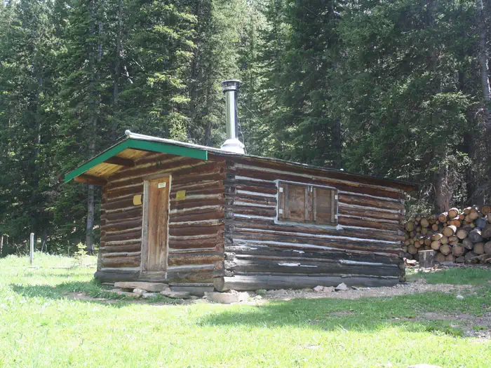
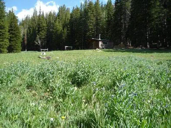
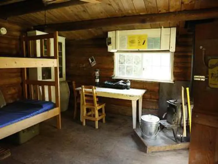
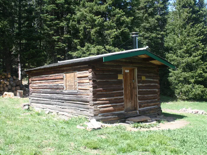
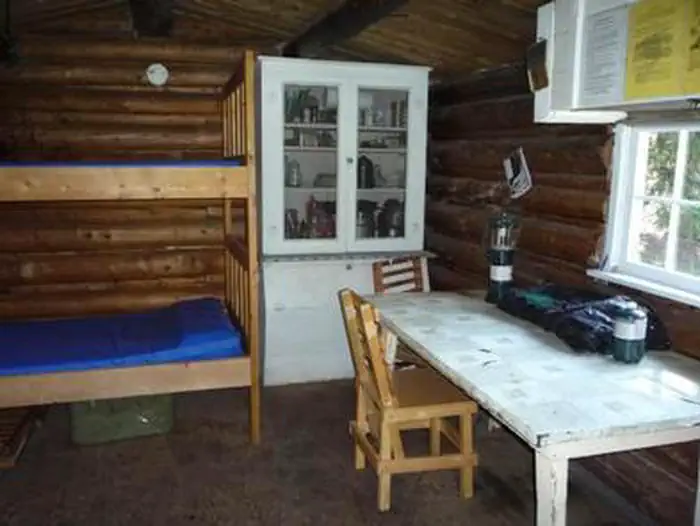
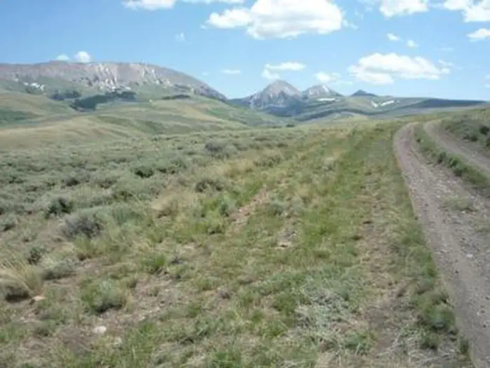
Overview Notch Cabin is located in a remote part of southwestern Montana, within proposed wilderness, and is open from July 1 through November. It is somewhat difficult to access, but worth the trouble for outdoor enthusiasts. The surrounding landscape is thick with sage and grasslands, transitioning to timbered slopes that are home to a full variety of wildlife. The original cabin burned to the ground in 2019 and a replacement, following the design of the original cabin, was built by Forest Service crews in the summers of 2024 - 2026. The 12' x 16' cabin accommodates 2 people. A high-clearance, four-wheel drive vehicle is required to access the cabin, which is located near the end of a very rough primitive road, with large rocks and deep ruts. The road may be impassable when wet. Motorized travel off of the designated route is not permitted. The cabin offers some basic amenities. Guests are responsible for their own travel arrangements and safety, and must bring most of their own supplies and gear.Recreation In addition to big game hunting, visitors can enjoy hiking, backpacking and horseback riding in the area. While no Forest Service trails are within the immediate vicinity of the cabin, the Snowcrest Trail is within a mile. It covers the entire range, providing panoramic views of the area. The 40-mile trail can serve as a hearty horseback riding adventure, a lengthy backpacking trip, or make for several day trips. The nearby seasonal mountain streams offer access to fishing. Anglers can enjoy a possible catch of cutthroat trout, among other species. Rock Creel Lake, with fishing opportunities, is only a few miles away. The wildlife management area is good for hunting but also offers a perfect opportunity for visitors to catch a glimpse of wildlife in their natural habitat. Due to the high elevation and short growing season, supplemental feed (certified weed-free) should be brought in for recreational livestock . No pasture or corral is available. The final two m
Photos
NOTCH CABINNOTCH CABINNOTCH CABINNOTCH CABIN
How to Get There
Notch Cabin is about 62 miles from Ennis, Montana. The final 28 miles are gravel, dirt or primitive two-track. From Ennis, take Montana Highway 287 west for 23 miles to Alder. At Alder, turn south toward Ruby Reservoir (County 248) and travel 21 miles. Turn right on Ledford Creek Road (County 50) and travel southwest for 3 miles to signed junction. Turn right onto Robb Creek road and after about 4.5 miles, you'll enter the Robb-Ledford WMA. Continue for 0.5 mile to junction, turn right and travel for 5 miles. At that point, the Springbrook road joins in from the west. Continue south toward the mountains and cross Robb Creek after about 3.5 miles. One half mile farther, you'll reach the Forest boundary, then another mile to the cabin. The route is signed at the junctions. Driving time from Ennis is about 2.5 hours, with the last 9 miles taking over an hour. As an alternative route, travel south from Alder for 14 miles and turn onto Sweetwater Road toward Dillon. Travel almost 9 miles and turn left onto Springbrook Road. This 2-track road will connect with the Robb Creek Road after about 12 miles. Follow Robb Creek directions from there. This route is not signed, other than the Springbrook/Sweetwater junction and there will be gates to open and close. See Beaverhead-Deerlodge National Forest-South map for details.
Download your route in advance via Gaia, Caltopo, or OSM-based apps.
Recommendations adapt to the current forecast + trail stats. Use them as a starting point — local conditions, your experience, and the time of day you start all matter.
Plan Your Visit to NOTCH CABIN
Heading to NOTCH CABIN? A few things to know before you go:
Reservations: popular sites fill up fast — check Recreation.gov 6 months in advance
Fees: day-use and camping fees vary; check current rates on the official park page
Trash & pack-out: follow Leave No Trace principles
Wildlife: store food in bear boxes where provided; never feed wildlife
Weather: the 5-day forecast above is updated every 6 hours; verify just before you go
Frequently Asked Questions
Do I need a reservation for NOTCH CABIN?
No central reservation system listed for NOTCH CABIN. Check the official page (https://www.recreation.gov/camping/campgrounds/234321) for the latest entry policy and availability.
How many campsites are at NOTCH CABIN?
NOTCH CABIN has 1 campsites. Site amenities (hookups, vehicle limits, ADA access) vary — see the individual campsite pages for details.
How do I get to NOTCH CABIN?
Notch Cabin is about 62 miles from Ennis, Montana. The final 28 miles are gravel, dirt or primitive two-track. From Ennis, take Montana Highway 287 west for 23 miles to Alder. At Alder, turn south toward Ruby Reservoir (County 248) and travel 21 miles. Turn right on Ledford Creek Road (County 50) and travel southwest for 3 miles to signed junction. Turn right onto Robb Creek road and after about 4…