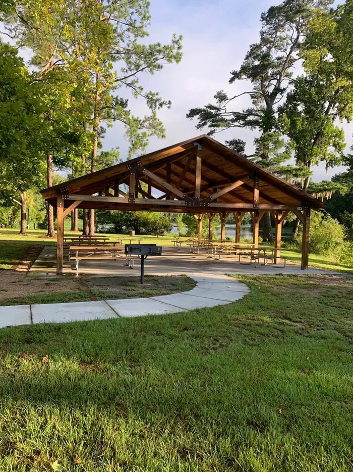
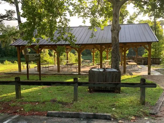
Overview Faceville Landing picnic shelter is located on Lake Seminole in Southwest Georgia. The lake and surrounding area provide a variety of outdoor recreational opportunities for fishing, camping, boating, picnicking, hiking, biking and birding. Faceville offers ample opportunites for bank fishing or picnicing in a …
Overview Faceville Landing picnic shelter is located on Lake Seminole in Southwest Georgia. The lake and surrounding area provide a variety of outdoor recreational opportunities for fishing, camping, boating, picnicking, hiking, biking and birding. Faceville offers ample opportunites for bank fishing or picnicing in a quiet cove. Recreation Lake Seminole is known as one of the best sites for sports fishing in America. Extensive stump and grass beds provide abundant cover where anglers fish for largemouth, hybrid, striped and white bass. Sizable populations of catfish, crappie and bream are also present. Over 79 species of fish have been identified in the lake. Facilities Faceville Landing Park has pit toilet restroom facilities within walking distance to the shelter. A boat ramp provides access to the lake. The park has a fishing pier. There are 8 picnic tables and a grill located at the shelter. No water or electricity is available at this shelter. Natural Features Lake Seminole has a surface area of 37,500 acres with 376 miles of shoreline. A pine and hardwood forest covers the rolling hills around the lake. A variety of wildlife makes its home around Seminole Lake, including raccoons, alligators, ring-necked ducks, canvasbacks, scaup, hawks, bald eagles, black vultures, tortoises and snakes. Contact Info For facility specific information, please call (229) 662-2001.
Photos
Faceville Shelter side view — USACEFaceville Group Picnic Shelter — USACE
How to Get There
From Bainbridge: Take GA Hwy 97 (Faceville Hwy) south for approximately 13 miles. Turn right onto Faceville Landing Road. The road dead ends in the park. From Hwy 90: Take GA Hwy 97 (Faceville Hwy) north for approximately 8 miles. Turn left onto Faceville Landing Road. The road dead ends in the park.
Download your route in advance via Gaia, Caltopo, or OSM-based apps.
Recommendations adapt to the current forecast + trail stats. Use them as a starting point — local conditions, your experience, and the time of day you start all matter.
Plan Your Visit to Faceville Landing Park
Heading to Faceville Landing Park? A few things to know before you go:
Reservations: popular sites fill up fast — check Recreation.gov 6 months in advance
Fees: day-use and camping fees vary; check current rates on the official park page
Trash & pack-out: follow Leave No Trace principles
Wildlife: store food in bear boxes where provided; never feed wildlife
Weather: the 5-day forecast above is updated every 6 hours; verify just before you go
Frequently Asked Questions
Do I need a reservation for Faceville Landing Park?
No central reservation system listed for Faceville Landing Park. Check the official page (https://www.recreation.gov/camping/campgrounds/10150481) for the latest entry policy and availability.
How do I get to Faceville Landing Park?
From Bainbridge: Take GA Hwy 97 (Faceville Hwy) south for approximately 13 miles. Turn right onto Faceville Landing Road. The road dead ends in the park. From Hwy 90: Take GA Hwy 97 (Faceville Hwy) north for approximately 8 miles. Turn left onto Faceville Landing Road. The road dead ends in the park.