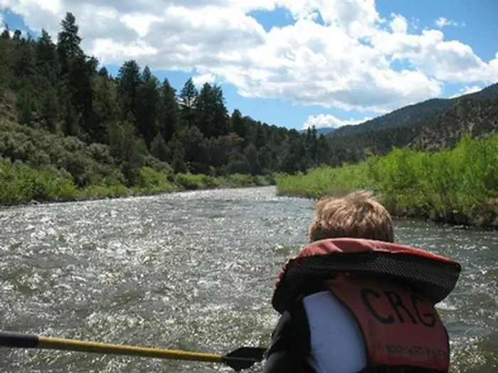
About State Bridge Recreation Site
State Bridge is a river access and parking site along the Upper Colorado River. The river segment between Pumphouse and State Bridge has heavy public use. Below State Bridge, fewer boaters are seen. Site features include one paved boat launch and an unpaved small-craft launch, toilets, dressing rooms, garbage service and non-potable water. The original State Bridge over the Colorado River was built in 1860, and was one of the oldest vehicular bridges in Colorado. It was pivotal in the development of North Park and the Yampa Valley regions of northwest Colorado. The bridge was replaced with a modern bridge in 1966. Portions of the old bridge can be seen in the middle of the river and on the north bank. For more information, please contact the Kremmling Field Office.
How to Get There
State Bridge is located on the Upper Colorado River along the Colorado River Headwaters Scenic Byway between Bond and Kremmling and 14 mile from Highway I-70 and the Wolcott exit. Easily accessible From I-70 at Wolcott (Exit #157), State Bridge is only a 40 minute drive from Vail and 1 hour from Steamboat Springs and Winter Park. FROM DENVER OR WEST COLORADO - Take I-70 to Exit #157 at Wolcott. Follow signs toward Steamboat Springs, Highway 131 north. In 14.4 miles, you cross the Colorado River, and you're looking at State Bridge. Take a right just after the bridge onto Trough Road and you're there. FROM ESTES PARK - Take US-34 West to Granby. Take US-40 West to Kremmling. Turn left on CO-9 South for about 2 miles. After crossing the river, turn right (West) on the Colorado River Headwaters Scenic Byway (Grand County Rt #1) and follow the river for 19 miles. Rancho Del Rio is on the right. FROM ESTES PARK - Take US-34 West through Granby to Kremmling. Turn left on CO-9 South for about 2 miles. After crossing the river, turn right (West) on the Colorado River Headwaters Scenic Byway (Grand County Rt #1), also known as Trough Road, and follow the river for about 22 miles to State Bridge.
Driving directions (Google Maps) →Plan Your Visit to State Bridge Recreation Site
Heading to State Bridge Recreation Site? A few things to know before you go:
- Reservations: popular sites fill up fast — check Recreation.gov 6 months in advance
- Fees: day-use and camping fees vary; check current rates on the official park page
- Trash & pack-out: follow Leave No Trace principles
- Wildlife: store food in bear boxes where provided; never feed wildlife
- Weather: the 5-day forecast above is updated every 6 hours; verify just before you go
Frequently Asked Questions
Do I need a reservation for State Bridge Recreation Site?
No central reservation system listed for State Bridge Recreation Site. Check the official page (https://www.recreation.gov/camping/campgrounds/271731) for the latest entry policy and availability.
Is State Bridge Recreation Site accessible?
ADA Toilets Available
How do I get to State Bridge Recreation Site?
State Bridge is located on the Upper Colorado River along the Colorado River Headwaters Scenic Byway between Bond and Kremmling and 14 mile from Highway I-70 and the Wolcott exit. Easily accessible From I-70 at Wolcott (Exit #157), State Bridge is only a 40 minute drive from Vail and 1 hour from Steamboat Springs and Winter Park. FROM DENVER OR WEST COLORADO - Take I-70 to Exit #157 at Wolcott. Fo…
How do I contact State Bridge Recreation Site?
You can reach the park at phone: 970-724-3000 or email: [email protected].
References & Official Resources