Baker, California · White Pine County · Campground
Overview In Lower Lehman Creek Campground, set among the lush green vegetation which hugs Lehman Creek, you'll secure your tent or park your RV within earshot of clear mountain water which has tumbled 3,000 vertical feet from the lakes and snowfields of the high Snake Range. Naturally landscaped with red-barked water b…
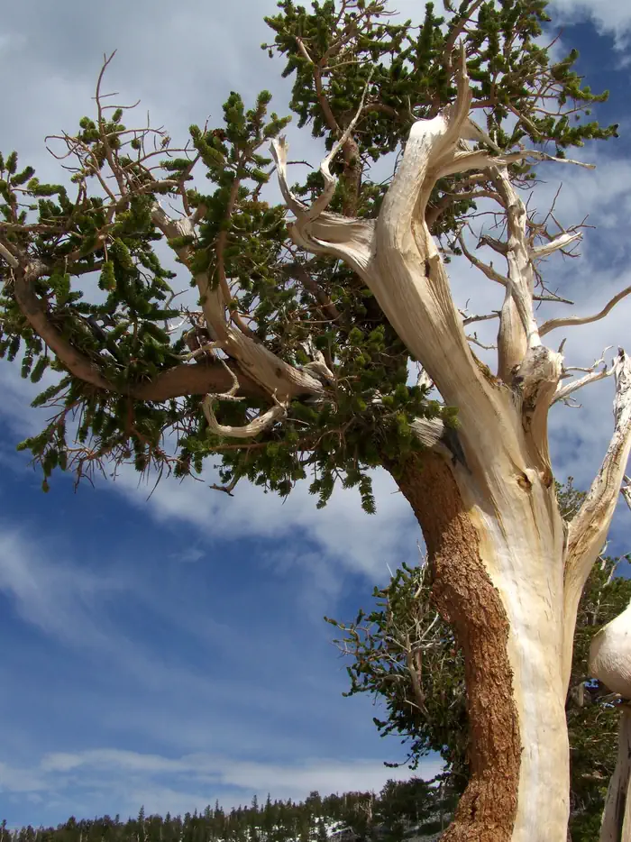
Overview In Lower Lehman Creek Campground, set among the lush green vegetation which hugs Lehman Creek, you'll secure your tent or park your RV within earshot of clear mountain water which has tumbled 3,000 vertical feet from the lakes and snowfields of the high Snake Range. Naturally landscaped with red-barked water birch, aspen and white fir a stroll through this sky island ecosystem provides for great bird-watching or a cooling dip in the stream while placing you just minutes from spectacular Lehman Caves. Be sure to make a reservation for a cave tour before you arrive in the park.Note: Campsites 11-20 are located along a paved loop road. However, that road is not currently showing correctly on Recreation.gov. We are working to resolve this issue; until then, please know that these sites are completely accessible by road.Recreation For guests at Lower Lehman Creek Campground a number of recreational options present themselves. The jaw-dropping Wheeler Peak Scenic Drive runs right past the campground entrance offering 12 miles of spectacular mountain and valley views while transporting you to near tree line at about 10,000 feet in elevation. From there a roundtrip hike of just under three miles will leave you with memories of iconic bristlecone pines, which can endure for over 4,000 years and stand for thousands more after death. Another short stroll from the end of the Scenic Drive highlights Stella and Teresa Lakes, both fish free because they freeze solid during the winter months, but begging for a sunset photograph with colossal Wheeler Peak looming in the background. If a challenge is beckoning, you'll find ample beyond the Summit Trailhead. Beginning at mile 11 of the Scenic Drive the Summit Trail will launch you on an eight-mile, day-long endeavor to the roof of Wheeler Peak itself, where you may ponder the desperate lives of bristlecones, limber pines and Engelmann spruce gracing the rocky moraine below the summit. Renowned Lehman Caves is just a 10-minute
Photos
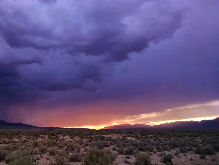
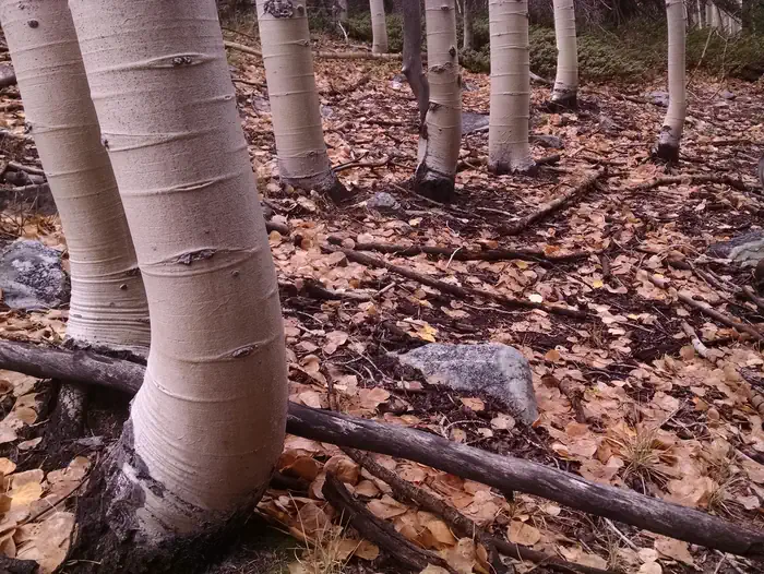
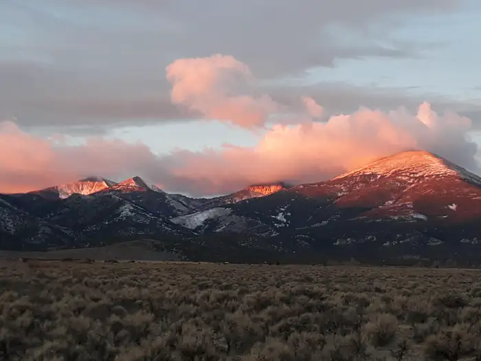
Sage and desert shrubs with an overcast sunset sky above — NPS/Robb ReinhartWhite aspen trunks and fallen leaves — NPS/Robb ReinhartSnowy mountain peaks glowing with sunrise colors — NPS/Robb ReinhartAncient bristlecone pine with blue sky and clouds behind. — NPS/Robb Reinhart
How to Get There
From the east or west: From U.S. Highway 6 & 50, turn south on Nevada State Highway 487 and travel 5 miles to Baker, NV. In Baker turn west on Highway 488 and travel 5 miles to the park. From the south (Utah): Travel north on Utah State Highway 21 through Milford, UT and Garrison, UT, which will become Nevada State Highway 487 as you cross the border. Turn west on Highway 488 in Baker and travel 5 miles to the park. From the south (Nevada): Travel north on U.S. Highway 93 (Great Basin Highway). At the junction of U.S. Highway 6 & 50 drive east to Nevada State Highway 487 and turn south. Travel 5 miles to Baker, NV. In Baker turn west on Highway 488 and travel 5 miles to the park.
Download your route in advance via Gaia, Caltopo, or OSM-based apps.
Recommendations adapt to the current forecast + trail stats. Use them as a starting point — local conditions, your experience, and the time of day you start all matter.
Plan Your Visit to Lower Lehman Creek Campground
Heading to Lower Lehman Creek Campground? A few things to know before you go:
Reservations: popular sites fill up fast — check Recreation.gov 6 months in advance
Fees: day-use and camping fees vary; check current rates on the official park page
Trash & pack-out: follow Leave No Trace principles
Wildlife: store food in bear boxes where provided; never feed wildlife
Weather: the 5-day forecast above is updated every 6 hours; verify just before you go
Frequently Asked Questions
Do I need a reservation for Lower Lehman Creek Campground?
No central reservation system listed for Lower Lehman Creek Campground. Check the official page (https://www.recreation.gov/camping/campgrounds/10101362) for the latest entry policy and availability.
How many campsites are at Lower Lehman Creek Campground?
Lower Lehman Creek Campground has 20 campsites. Site amenities (hookups, vehicle limits, ADA access) vary — see the individual campsite pages for details.
How do I get to Lower Lehman Creek Campground?
From the east or west: From U.S. Highway 6 & 50, turn south on Nevada State Highway 487 and travel 5 miles to Baker, NV. In Baker turn west on Highway 488 and travel 5 miles to the park. From the south (Utah): Travel north on Utah State Highway 21 through Milford, UT and Garrison, UT, which will become Nevada State Highway 487 as you cross the border. Turn west on Highway 488 in Baker and travel 5…