Eagleville, California · Modoc County · Campground
Overview *Altitude is 7,080 feet above sea level* Set on the edge of a meadow surrounded by Aspen, Fir and Pine trees, Patterson Guard Station has stood since 1921. It served the Modoc National Forest as a fully staffed fire office and guard station until 1981. Just a few footsteps from the Summit Trail and one-quarter…
Overview *Altitude is 7,080 feet above sea level* Set on the edge of a meadow surrounded by Aspen, Fir and Pine trees, Patterson Guard Station has stood since 1921. It served the Modoc National Forest as a fully staffed fire office and guard station until 1981. Just a few footsteps from the Summit Trail and one-quarter mile from the wilderness boundary, Patterson Guard Station can be your basecamp for trips into the South Warner Wilderness or the perfect place to disconnect and relax. The cabin only has one set of bunkbeds (two mattresses). There is a large turn-around parking area directly adjacent to the cabin which can accommodate camper trailers, smaller RVs and gooseneck horse trailers. No hook-ups. If your party exceeds 8 persons, the adjacent Patterson Campground offers 6 developed campsites for $15/night. Click here to view the full reservation calander and additional details not included on this page. Recreation Hiking & Horseback Riding The nearby trails within the South Warner Wilderness offer wild landscapes and solitude for hikers and horseback riders. The Wilderness Act of 1964 prohibits the use of motorized and/or mechanized equipment within the Wilderness area (limited exceptions are provided by the Americans with Disabilities Act). South Warner WIlderness maps are advised and always available at the Modoc National Forest Supervisor's Office in Alturas, Calif. Maps may also be available at the Likely General Store in Likely, Calif. Off-Highway Vehicles Many of the roads near Patterson Guard Station, outside of the wilderness area, are open to Off-Highway Vehicles. Motor Vehicle Use Maps are available online and at the Modoc National Forest Supervisor's Office in Alturas, Calif. Boating Blue Lake, 9 miles west, features a boat ramp and dock for motorized and non-motorized watercraft. Help keep this lake clean by following the California Invasive Species Prevention Program Please respect the 10 mph speed limit on the lake. If speed-boating is your thin
Photos
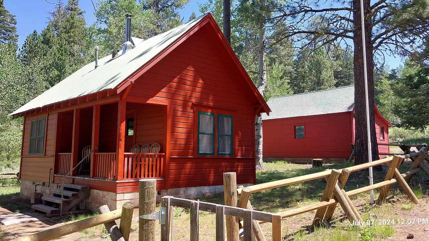
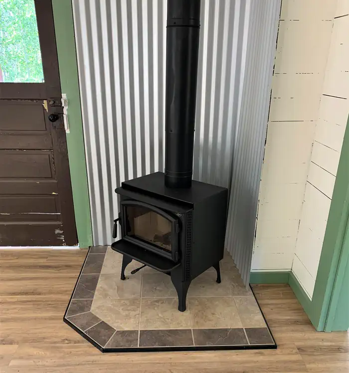
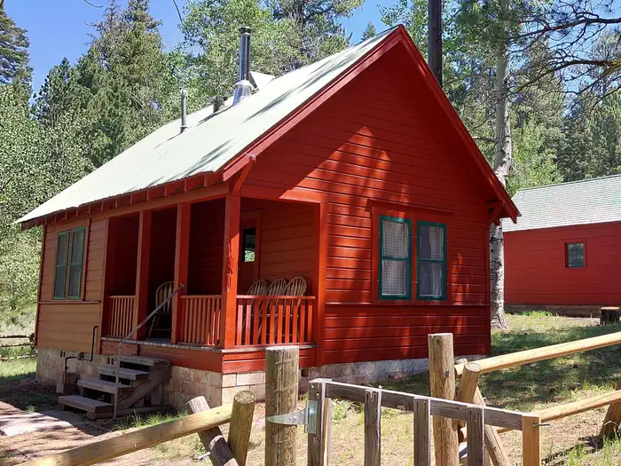
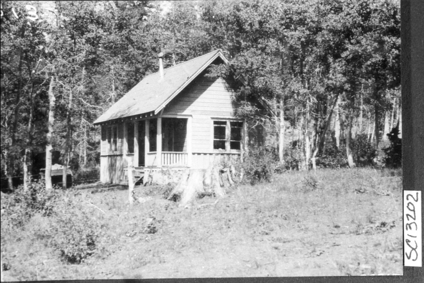
bright red wooden rails frame the front porch of the guard station where a wooden chair offers a view of the adjacent meadow on a sunny day. — USDA Forest ServiceA new wood stove installed near the front door. — USDA Forest ServiceBunk beds and chairs in the main living room seen from the kitchen. The scene is dimly lit as sunlight enters the room through 3 large windows. — USDA Forest ServiceA sunny day illuminates Patterson Guard Station. The bright red color of the Guard Station contrasts the green conifer trees behind it. — USDA Forest ServiceView entering from the back door looking into the Kitchen. Stove, refrigerator and kitchen table are in the center of the photo. — USDA Forest ServicePatterson Mill Ranger Station built by Ranger Ben Johnson as summer headquarters for working in the South Warners. — Modoc National ForestView of the rear of the guard station, facing the back door. A water faucet is in the foreground and the Aspen leaves in the background are starting to turn yellow. — USDA Forest Service
How to Get There
From Alturas, California, travel South on U.S. Highway 395 for 18 miles to the town of Likely and Turn left (East) onto County Rd 64. Continue for 9 miles toward Jess Valley and stay right at the fork toward Blue Lake (Blue Lake Road), this road is not maintained for winter travel. The pavement ends in approximately 6.5 miles, and the road becomes Forest Road 39N01 (South Warner Road). Continue 7.5 miles and turn left (North) at the sign for Patterson Campground (Forest Road 39N28), stay left to reach Patterson Guard Station.
Download your route in advance via Gaia, Caltopo, or OSM-based apps.
Recommendations adapt to the current forecast + trail stats. Use them as a starting point — local conditions, your experience, and the time of day you start all matter.
Plan Your Visit to Patterson Guard Station
Heading to Patterson Guard Station? A few things to know before you go:
Reservations: popular sites fill up fast — check Recreation.gov 6 months in advance
Fees: day-use and camping fees vary; check current rates on the official park page
Trash & pack-out: follow Leave No Trace principles
Wildlife: store food in bear boxes where provided; never feed wildlife
Weather: the 5-day forecast above is updated every 6 hours; verify just before you go
Frequently Asked Questions
Do I need a reservation for Patterson Guard Station?
No central reservation system listed for Patterson Guard Station. Check the official page (https://www.recreation.gov/camping/campgrounds/10229798) for the latest entry policy and availability.
How do I get to Patterson Guard Station?
From Alturas, California, travel South on U.S. Highway 395 for 18 miles to the town of Likely and Turn left (East) onto County Rd 64. Continue for 9 miles toward Jess Valley and stay right at the fork toward Blue Lake (Blue Lake Road), this road is not maintained for winter travel. The pavement ends in approximately 6.5 miles, and the road becomes Forest Road 39N01 (South Warner Road). Continue 7.…
How do I contact Patterson Guard Station?
You can reach the park at phone: 530-233-5811 or email: [email protected].