Ward Cove, Alaska · Ketchikan Gateway County · Campground
Overview Blind Pass Cabin sits on the northwest shore of Hassler Island, on Blind Pass. This secluded retreat is open year-round and makes an ideal base camp for exploring the various bays and inlets in the northern Behm Canal area. The site can be accessed by float plane, boat or kayak, depending on conditions. Guests…
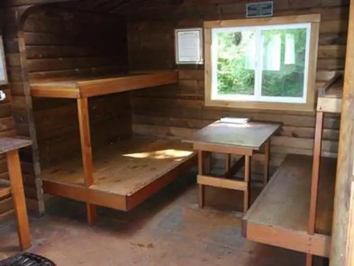
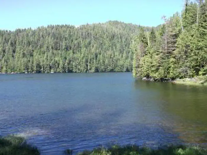
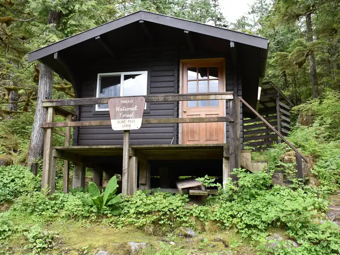
Overview Blind Pass Cabin sits on the northwest shore of Hassler Island, on Blind Pass. This secluded retreat is open year-round and makes an ideal base camp for exploring the various bays and inlets in the northern Behm Canal area. The site can be accessed by float plane, boat or kayak, depending on conditions. Guests are responsible for their own travel arrangements and safety, and must bring several of their own amenities.Recreation The area is noted for king salmon runs into the Unuk River, with other salmon species, halibut, red snapper, Dungeness crab and shrimp also in abundance. A freshwater lake with trout is located about a half-mile upstream from the cabin. There is no trail to the lake. Sea kayaking is a popular mode of transportation, and many kayakers use this cabin as a base for exploring Bell Island, Gedney Pass and Bell Arm. It is also possible to kayak to Bailey Bay and hike to the Lake Shelokum Hot Springs. Guests must supply their own equipment and should consult local tide tables before departing. Hunting is also possible in designated seasons with a permit.Facilities This 12-by-14 cabin ( pan-abode style ) has two single bunks and two double bunks, to sleep up to six people. It is also equipped with a table and benches, broom, tiny woood stove and an outhouse. A mooring float is available, but it is not for the exclusive use of cabin guests. Water and electricity are not provided. Firewood maybe avaliable but guest should consider brining some compressed log firewood to utilize in the Tiny Wood Stove. Water is available from a nearby creek, but guests should be sure to treat any water taken from a natural source prior to drinking or cooking with it ( water safety tips ). It is recommended that guests bring their own water supply. Other items to pack include sleeping bags, sleeping pads, lanterns or flashlights, cookware, plates, utensils, food, toilet paper, garbage bags, a fire extinguisher and matches, among other necessities. Guests are expe
Photos
Tiny Wood Stove — USFSBunk Area — USFSBlind Pass — USFSBlindpass Cabin from Front — USFS
How to Get There
The cabin is located approximately 40 air miles north of Ketchikan on the northwest shore of Hassler Island, across from Black Island. Accessible by float plane or by boat. Mooring buoy in front of cabin is first-come, first-serve. Refer to USGS topographic map, Ketchikan D-5, and check local tide tables to determine best times for arrival and departure.
Download your route in advance via Gaia, Caltopo, or OSM-based apps.
Recommendations adapt to the current forecast + trail stats. Use them as a starting point — local conditions, your experience, and the time of day you start all matter.
Plan Your Visit to BLIND PASS CABIN
Heading to BLIND PASS CABIN? A few things to know before you go:
Reservations: popular sites fill up fast — check Recreation.gov 6 months in advance
Fees: day-use and camping fees vary; check current rates on the official park page
Trash & pack-out: follow Leave No Trace principles
Wildlife: store food in bear boxes where provided; never feed wildlife
Weather: the 5-day forecast above is updated every 6 hours; verify just before you go
Frequently Asked Questions
Do I need a reservation for BLIND PASS CABIN?
No central reservation system listed for BLIND PASS CABIN. Check the official page (https://www.recreation.gov/camping/campgrounds/232950) for the latest entry policy and availability.
How do I get to BLIND PASS CABIN?
The cabin is located approximately 40 air miles north of Ketchikan on the northwest shore of Hassler Island, across from Black Island. Accessible by float plane or by boat. Mooring buoy in front of cabin is first-come, first-serve. Refer to USGS topographic map, Ketchikan D-5, and check local tide tables to determine best times for arrival and departure.